Quickvew Data Visualization
The QuickView data visualization application runs on GeoCloud Servers to provide continuous graphical access to instrumentation data. Datasheet
Quickview Advantages
Continuous Availability: QV operates 24/7, automating data retrieval, importing and processing readings, checking for alarms, and generating plots and reports.
Consistent Calculations: QV processes incoming readings by applying calibration factors, baseline readings, and calculation instructions stored in a sensor table.
Consistent Presentations: Views, plots,and reports can be preconfigured to ensure consistent scales, terminology, and sensor selection. Values are updated automatically.
Wide Compatibility: GeoCloud’s specialized preprocessing applications extend QV’s functionality, provide compatibility with nearly any type of monitoring device, and eliminate data silos and the need to switch applications to view specialized data.
Centralized Data Storage: QV stores all types of project-related data to maintain traceability and simplify access, including action plans, calibration sheets, reports, journal entries, borehole logs, and photos.
Secure Access: The QuickView website supports two-factor authentication and three levels of user permissions. Authorized users get quick, secure access to data wherever there is an internet connection.
Quickview Features
Sensor Compatibility
QV can work with any type of sensor. In addition to preprocessing modules supplied by GeoCloud, QV has a built-in UI for defining new sensors and data formats.
Processing
Running on GeoCloud servers, QV stores and applies calibration factors to convert raw data to engineering units. QV also provides:
- Easy baseline management
- Most mathematical functions
- Virtual sensors
- Cumulative displacement calculations
- Averaging of data in charts
- Slope and deflection ratios
- Cant and twist calculations
Presentation
- Geospatial coordinate support
- Multiple views of the project
- Maps and images as base layers
- Contour overlays
- Client logos on views
Plot Types
- Time plots
- Profile plots (inclinometers, etc)
- Pre-configured plots for standardization and reports
- On-the-fly plots for investigations
- Pop-up plots when cursor touches sensors
Alarms
- Threshold alarms
- Watchdog alarms
Annotations
- Advanced annotation functions
- Alarm trigger values in plots
- Predicted deformations
- Tunnel alignments & TBM movements
Archives
- Installation reports
- Calibration certifications
- Photographs
- Alarm logs
- Raw data
Security Features
- Hosted on Microsoft Azure platform in US
- Azure core services uptime is 99.99%
- Data encrypted in transit and at rest
- Daily backups of project website
- Two-factor authorization for logins
- Three permission levels for users
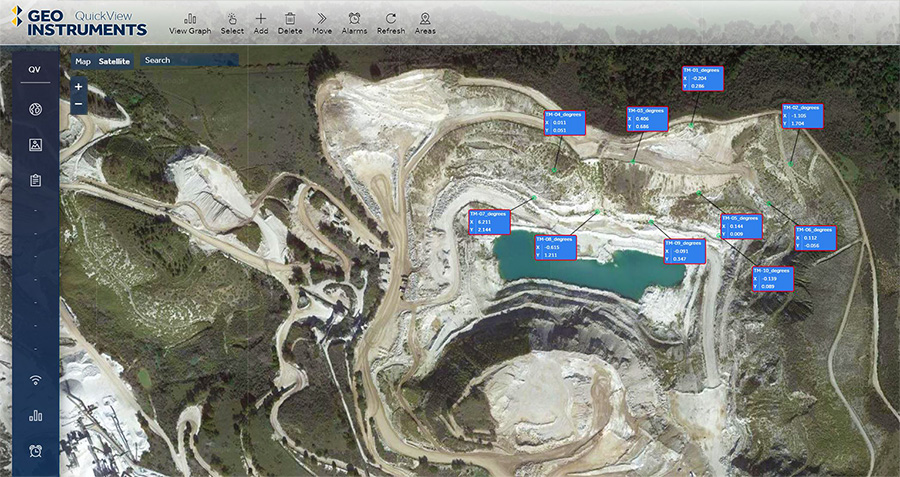
Quickview can provide multiple views of the site. CAD drawings, images, or maps can serve as base layers for a view. The screenshot above uses a satellite view. Layers for sensors and graphs are created automatically as needed.
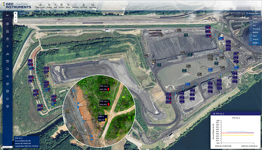
Sensors have their own layer. Labels show sensor ID, current reading, and alarm status. The magnified inset shows sensors with alarm flags. Views can be zoomed and each type of sensor can be toggled on and off for easier viewing.
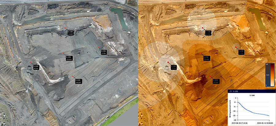
The view on the left shows five settlement sensors. The same view on the right has a contour overlay that provides a visual understanding of settlement. The small trend plot at right pops up when the cursor is rolled over a sensor.
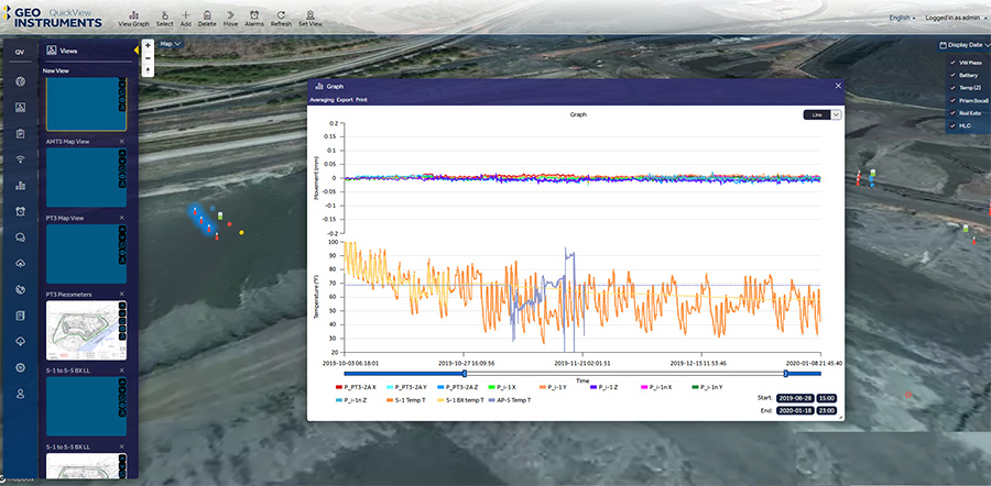
Graphs can be created from any sensors displayed on a view. Select the sensors and then click the View Graph command. QuickView automatically applies Y scales and labels for different types of sensors. The example above shows AMTS displacement data and temperature. Scales and date ranges can be changed on-the-fly.
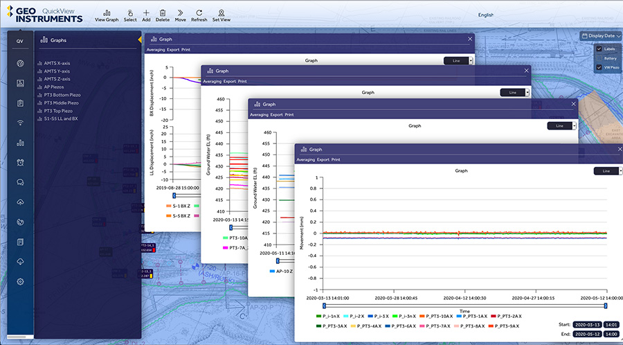
QuickView also provides definable graphs with preselected sensors and scaling. These graphs are available for immediate use, since no adjustments are needed. QuickView PDF reports are generated using these pre-defined graphs.
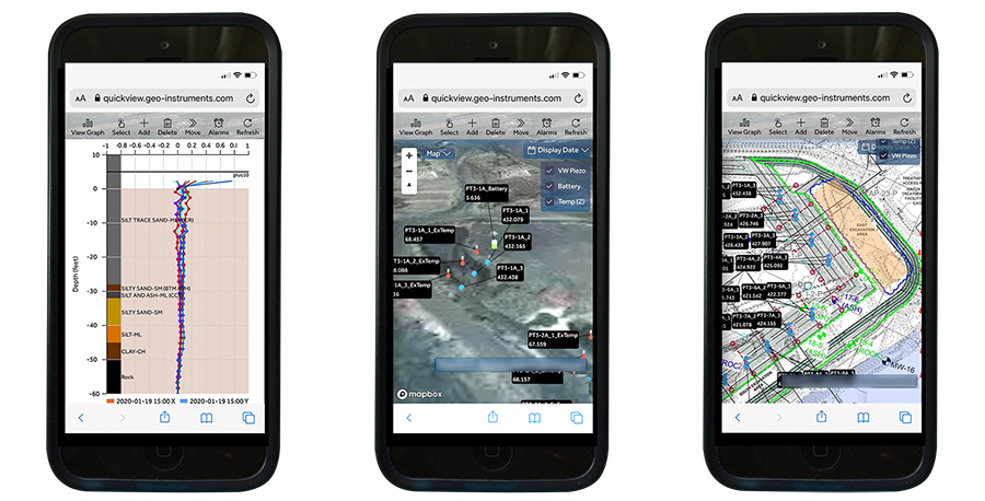
QuickView is fully mobile compatible. Views and graphs load quickly and can be zoomed.
