Transbay Transit Center
Project Overview
Construction of the Transbay Transit Center required a massive support of excavation system that included a cement-deep-soil-mixed perimeter wall, four levels of cross-lot bracing, and two levels of tiebacks.
Monitoring Requirements
To minimize risk, project owners wanted continuous monitoring of some 250 points within the excavation area, including points on soldier piles, walers, and the excavation trestle. The monitoring system was to obtain a full set of measurements every two hours and deliver them, processed and formatted, to the owner’s data visualization software.
Selection of Instruments
To meet these requirements, GEO-Instruments deployed geomatic instrumentation that included 6 AMTS (automated motorized total stations, 250 prisms, and Monstar processing software.
AMTS are enhanced versions of a surveyor’s robotic total station, an instrument that measures angles and distance to any number of distant targets. Since total stations can obtain measurements remotely, they can be installed at secure locations, safe from construction activity and well above street level, which is important for urban monitoring.
Prisms are small optical devices that serve as remote targets for the total stations. Prisms are ideal for this application, since they are inexpensive and can be installed in sufficient numbers to monitor a wide area. They are relatively easy to install as well, because they don’t use power or cables.
GEO’s Monstar software minimized measurement errors and then output measurements in project coordinates for easy use with other project documents, such as CAD-generated plan views and as-builts. Monstar played a critical role in both the setup and the monitoring phases of the instrumentation.
Deploying the System
Before construction activity begins, surveyors establish a coordinate framework. The physical markers of this framework include brass monuments, survey pins, drilled holes, and other devices. The most important of these markers are called primary control points, and surveyors use them to define other points in the coordinate framework.
The locations of the total stations had to be defined within the coordinate framework, but surveys from the primary control points were not possible because there was no line of sight to the total stations. To make the surveys, GEO had to establish secondary control points. Thus project coordinates were transferred from the primary control to the secondary control, and finally, through surveys, to the total stations. An exhaustive testing procedure verified that the coordinates were correct.
Maintaining Accuracy
Of necessity, the total stations were installed on structures adjacent to the excavation. Any movement of these structures would affect the measurements made by the total stations, unless appropriate adjustments could be applied.
To provide sufficient data for accurate adjustments, every measurement cycle included three measurements of not only the target prisms, but also the control prisms. To create a strong geometric network, each total station shared several target prisms and at least two control prisms with another total station, and all total stations were equipped with specially configured prisms that allowed them to measure each other. Accuracy was futher enhanced by monitoring temperature, barometric pressure, and humidity.
All of these measurements were fed into Monstar, which was able to output adjusted coordinates with a documented accuracy better than +/- 0.01 foot in all directions.
Urban Surprises
Monitoring in an urban environment is always challenging, but the duration of this project introduced a few surprises. In some cases, the construction of new buildings blocked line-of-sight to key control points. And in one case, the total station had to be relocated due to the pending demolition of the building it was mounted on. Fortunately, the monitoring system was designed to be robust and flexible enough to accomodate such events.
Results
GEO-Instruments monitoring system proved highly successful. Every two hours for the duration of the project, it delivered accurate measurements of 250 monitored points, providing critical observational data for evaluating operations and managing risks.
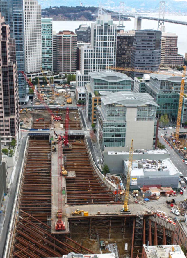
The Transbay Transit Center project involved a 65-foot deep excavation supported by a perimeter wall and 4 levels of cross-lot bracing.
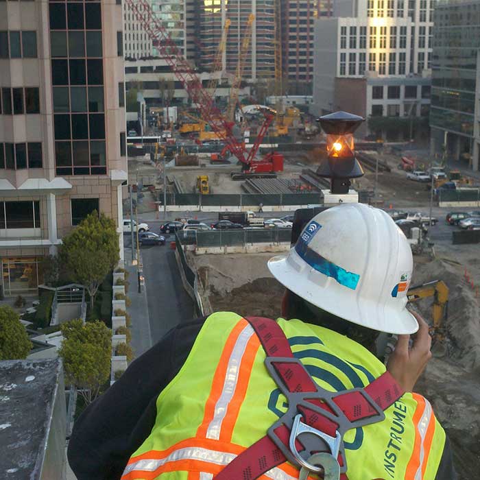
Before the excavation began in 2011, GEO deployed six automated total stations and 30 off-site control points.
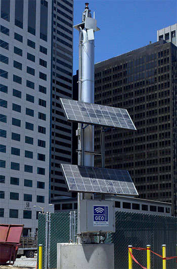
Two of the total stations were mounted on gravity-base towers, which were stable, but semi-portable.
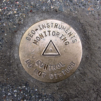
To survey the positions of the six total stations, GEO established secondary control points.
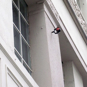
Control prisms were placed in stable locations far from the construction activity.
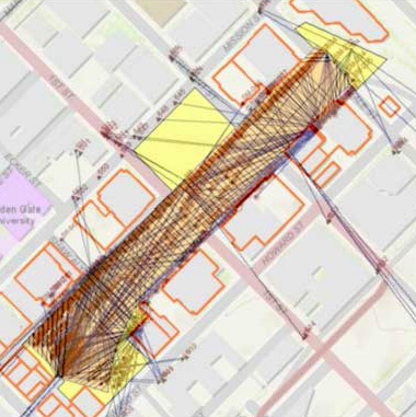
GEO established a strong geometric network that maintained high accuracy for the duration of the project.
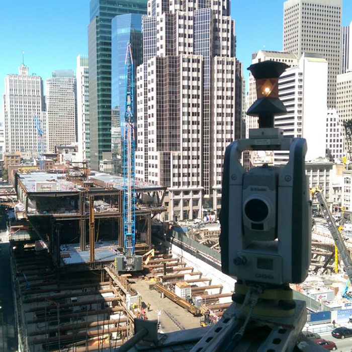
The site as of June 2015.
