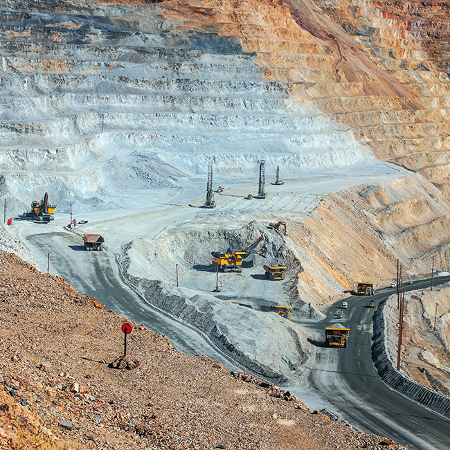
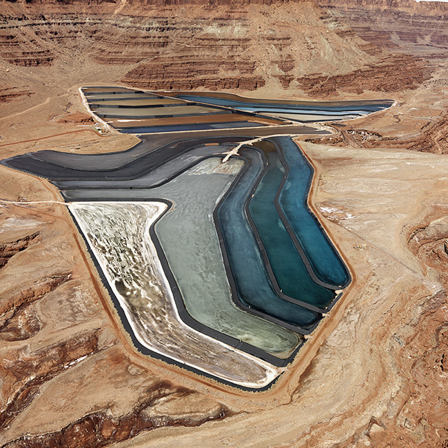
GEO provides automated systems for monitoring geotechnical and hydrological conditions at open-pit mines and tailings storage facilities.

Open-Pit Mines
Conditions at open pit mines change constantly due to ongoing operations. The redistribution of stresses and the unpredicted appearance of faults and joints, heavy rainfall events, and seismic activity all contribute to instability.
A wide range of automated instrumentation is available for monitoring surface displacements, sub-surface displacements, and hydrological conditions.

Tailings Storage Facilities
Tailings storage facilities (TSF) impound mine wastes. They are constructed constructed incrementally and operated even during construction phases. Extreme events such as seismic activity and water-inflows causing overtopping are the major causes of TSF failures, but instrumentation is useful to monitor stability of the embankments, detect seepage and piping, and assist water management.
Monitoring Surface Displacements
InSAR is a radar technology that can detect and monitor surface displacements over the entire area of the mine or TSF. Displacements are calculated by comparing satellite-acquired radar images. Data and deformation maps from InSAR providers are updated weekly every 6 to 12 days and can be imported into most data visualization platforms.
While InSAR does not specifically require any on-ground components, installation and maintenance of specialized "corner reflectors" may be needed at some sites to improve measurement consistency.
Measurement precision is currently sensitive to atmospheric conditions, but more advanced satellites and processing techniques are arriving soon.
GNSS Sensors use satellite signals and ground processing to provide 3D spatial measurements of their installed locations. Coverage depends on the number and location of sensors. Displacements are calculated by comparing successive measurements. Measurements are easily presented in data visualization platforms.
Installation requires line-of-sight to satellites. Sensors must be installed off the ground surface to avoid reflected signals. Measurements are not affected by fog, dust, snow, or rain, and no maintenance is required.
The most recent GNSS sensors are self-powered, self-reporting, and easy to install in open areas.
AMTS Systems monitor surface displacements by measuring the spatial position of remote prisms. The coverage area depends on the number and location of prisms. The high-precision measurements can be updated several times daily or even hourly and are easily presented on standard data visualization platforms.
Installation requires pedestals or mounting surfaces for all components and finding locations that provide good sight-lines between the AMTS unit and the prisms. Most AMTS systems are powered by battery and solar panel and transmit measurements to central locations via cellular networks or point-to-point radio.
AMTS systems are sensitive to fog, heat, dust, and snow. Periodic maintenance is required to clean lenses and prisms and to re-acquire any disturbed prisms.
Tiltmeters measure tilt. Rotational displacements are calculated by comparing the current measurement to the inital measurement. They can be installed on retaining or stakes driven into the ground. Self-powered, wireless tiltmeters obtain tilt readings autonomously and transmit them to an on-site gateway. Measurements are mainly used for warnings and are easily presented in data visualization platforms.
Laser Extensometers monitor displacements across faults and joints. They can be connected to self-powered, wireless loggers. Measurements are easily presented in data visualization platforms.
Monitoring Subsurface Displacements
Shape Arrays and In-Place Inclinometers monitor lateral displacement along the axis of a vertical borehole. Frequent measurements and near-real time alarms are possible. Measurements are typically presented as profile plots in data visualization platforms.
Installation requires drilling a borehole for both shape arrays and IPIs. Shape arrays can be installed in smooth, smaller diameter pipe. IPIs require installation of larger diameter grooved inclinometer casing.
The top of borehole is terminated with a battery-powered, wireless data logger that transmits to an on-site gateway. Battery changes are the only maintenance needed.
Monitoring Subsurface Conditions
Electrical Resistivity Tomography systems monitor subsurface conditions such as saturation, seepage, and erosion within tailings embankments. Automated systems can obtain daily measurements. Processing, analysis and data presentation is currently limited to dedicated, standalone software.
Installation requires a shallow trench for electrodes and connecting cable and a stand for the controller unit, wireless logger, and solar panel. Minor inspections and maintenance are required.
Time Domain Reflectometry systems detect the depths, size, and geometry of rock masses that are moving. Frequent measurements and near-real time alarms are possible. Processing, analysis, and data presentation is currently limited to dedicated, standalone software.
Installation requires drilling a borehole. The top of the borehole is terminated with a wireless logger. Little maintenance is required.
Monitoring Pore-Pressures & Water Levels
Piezometers monitor pore-water pressure or water levels. Frequent measurements and near-real time alarms are possible. Measurements are easily presented in standard data visualization platforms.
Installation requires drilling a borehole. For pore-pressure measurements, the piezometer tip must be isolated at a specific depth. For water level measurements, the tip is suspended in well casing. Vented cable or barometric corrections may be required for water level measurements.
The top of borehole or well is terminated with a compact, battery-powered logger. Both networked loggers and satellite loggers are available. Very little maintenance is required.
Monitoring Rainfall & Weather
Weather Stations monitor rainfall, which directly affects pore-water pressure and slope stability. Weather stations can also monitor other factors that affect mine safety, such as lightning strikes and wind. Measurements are recorded and forwarded to data visualization platforms via networked or satellite loggers. Maintenance involves period cleaning.
Data Integration & Visualization
Automated monitoring systems run continously, providing frequent measurements and assisting early identification of unwanted trends. Measurements are transmitted to a central location, such as a secure GeoCloud server, that accepts and integrates data from all the sensing systems. GeoCloud project websites check for alarms, update project databases, and generate graphical views, plots, and reports.
