GNSS Sensors
Locator One GNSS sensors are designed for automated monitoring of settlement and lateral displacements. Datasheet
GNSS Receivers
The Global Navigation Satellite System consists of satellites, ground control stations, and receivers. Each receiver acquires signals from constellations of satellites. The geodetic information coded in the signals is collected and processed to resolve the absolute geospatial location of the receiver.
Locator One GNSS Sensor
The Locator One is a compact, self-powered sensor that combines a GNSS receiver, ground-facing radar, and cloud connectivity. It autonomously acquires and transmits geodetic data to the Cloud.
The cloud server processes the geodetic information, applies adjustments, and outputs absolute coordinates. Changes from baseline coordinates reveal the magnitude and direction of displacements.
A GeoCloud project website presents the data visually in map views and graphs and sends out alerts if alarm thresholds are exceeded.
Locator One Applications
- Automating measurements of settlement plates, including both the settlement of the original ground surface and the current height of fill.
- Monitoring slope stability at open pit mines, tailings dams, and highway cuts.
- Monitoring horizontal displacement of earth retention structures such as MSE walls or sheet pile walls.
- Monitoring potential displacement and settlement of buildings and utilities near excavation and tunneling projects.
Locator One Advantages
- High-precision 3D measurements.
- No line-of sight issues and no problems with fog, rain, or snow.
- Simple to install, simple to use, and almost no maintenance.
- Very little equipment needed on site.
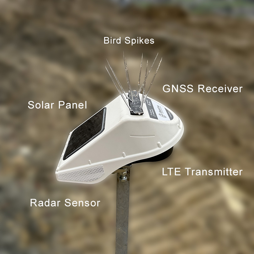
Locator One provides high precision measurements and is self-powered, weatherproof, and low maintenance.
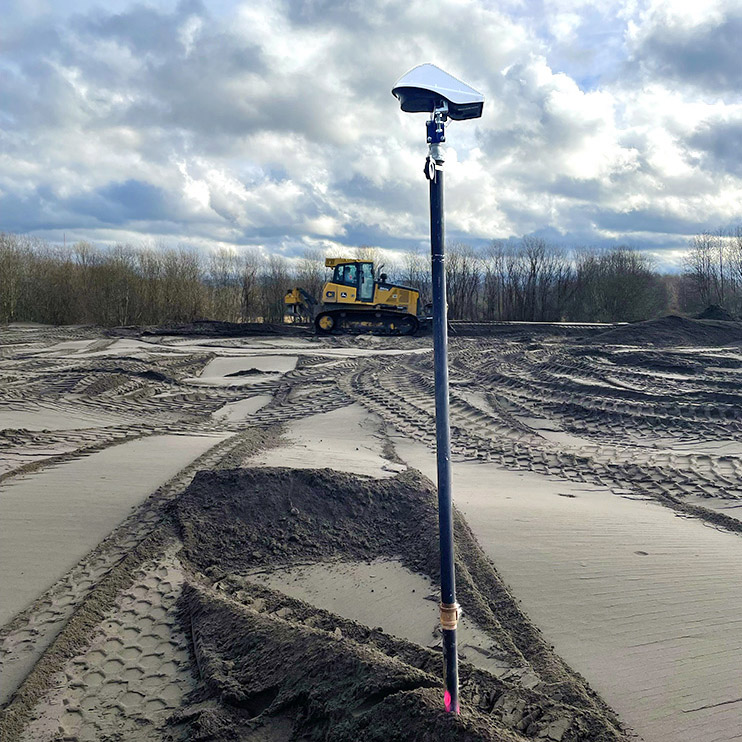
Locator One sensor monitors consolidation settlement. Radar sensor monitors distance to ground surface.
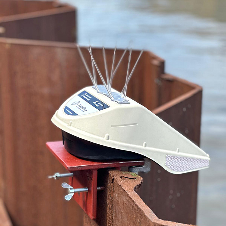
Locator One is easily installed on dams, bridges, aquaducts, storage tanks, and retaining walls.
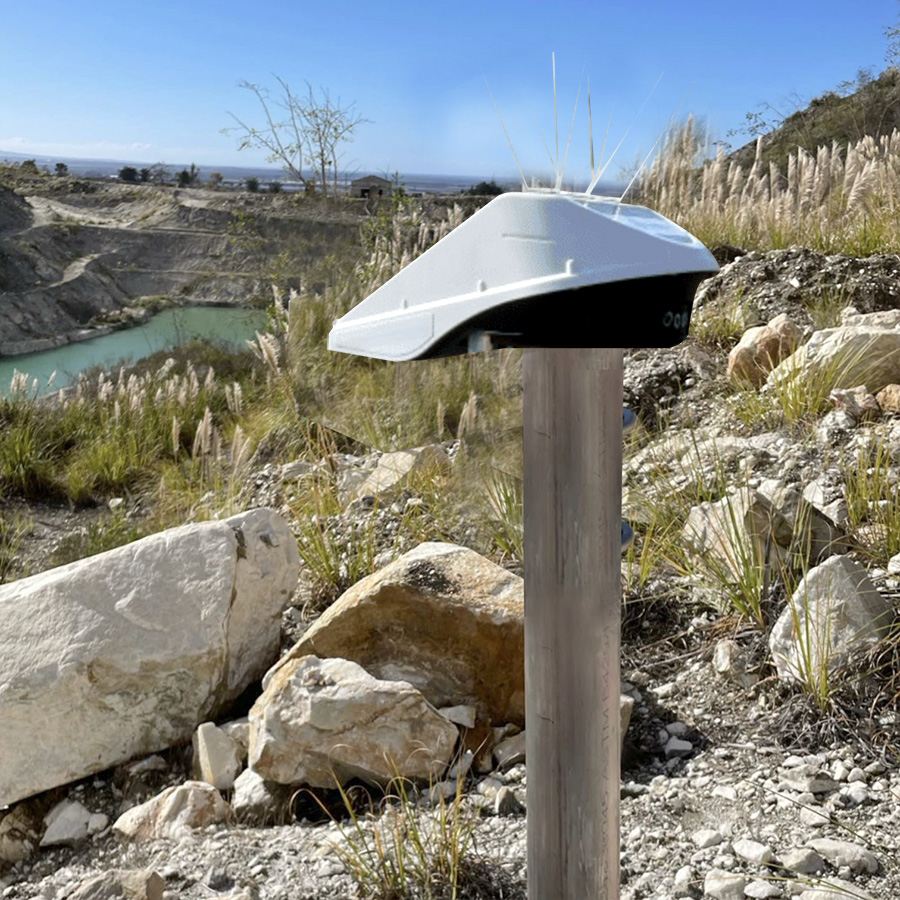
Locator One can monitor slope stability at open pit mines, tailings dams, embankments, and road cuts.
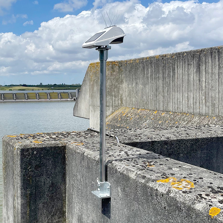
Locator One can be installed on vertical walls if elevated above obstructions.
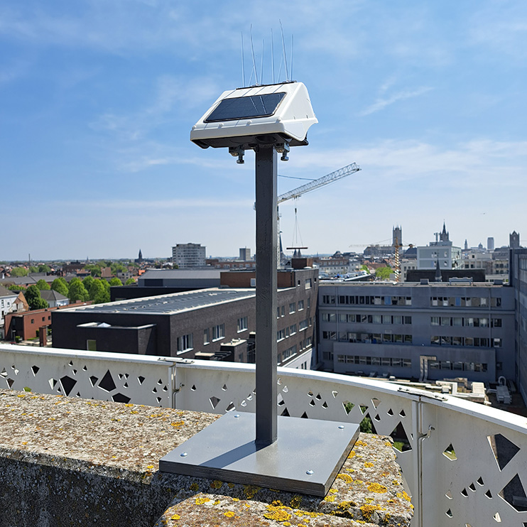
Locator One can be installed on structures to monitor for adverse effects of tunneling or excavation activities.
Locator One Specifications
Observation Technique: Fast-static, with 186 channels available for recording observations at 1Hz for 5 minutes. Default observation time can be modified as needed.
Maximum Baseline: 4 km. Baseline is the distance between sensor at a reference point and sensors at monitoring points.
Satellite Constellations: Compatible with GPS, GLOSNASS, Galileo, QZSS, and BeiDou satellites.
Averaged Post Processed Precision:
±2mm horizontal, ±4 mm vertical.
Measurements per Day: 6 per day is standard. Up to 24 per day is possible at ideal locations.
Weather Rating: IP 65 for water ingress, -4 to 140 °F for temperature.
Power: Supercapacitor charged by built-in solar panel. Fully charged supercapacitor can provide 8 months of power without solar.
Ground-Facing Radar: Millimeter precision when used with base plate as target. The radar has 13 foot range.
Basetime BV
Locator One GNSS Sensors are designed and manufactured in The Netherlands by Basetime BV. Specifications above are courtesy of Basetime BV.
Geo-Instruments is the U.S. distributor for Basetime BV
Installation Requirements
Cellular Connection: Cellular connectivity is required. Each sensor connects independently via its built-in universal SIM.
Measured Points: Locator One sensors can be mounted directly onto settlement plate risers or structures.
Reference Point: One sensor should be installed at a stable location outside the zone of influence. Its measurements are used in post processing to correct for atmospheric conditions. It transmits directly to the cloud, so line of sight to the measured points is not needed.
Clear Horizon: Ideal locations for the sensor have a clear horizon with no obstacles above an elevation of 10°. This is especially important for the reference point.
Mounting Hardware
Clamps: The sensor has two built-in clamps for attachment to a mounting plate.
Mounting Plate for Pipe: Connects sensor to 1-inch diameter pipe. Use Bell adaptor for 2-inch riser pipe.
Mounting Plate with Clamp: Clamps sensor to vertical elements such as a sheet pile.
Base Plate for Structures: Used to mount sensor on structure. Has holes for mounting bolts and threaded fitting for 1-inch standoff pipe.
Settlement Plates: Standard settlement plate components. Includes threaded mounting plate above. See Settlement plates
Request a Quote
Help Notes for Quote Request
Number of Sensors
Enter the number of monitoring points + 1 reference point.
Coordinate System
Relative to installed location provides precise measurements that are not tied to the project grid. No survey or geodetic knowledge is required.
Aligned to project grid provides measurements that are tied to the project grid. This requires knowledge of the coordinate system in use and the location of the reference point within that coordinate system.
Installation Services
Choose Required if you want GEO to install and configure the sensors. Choose Not Required if you will install by yourself.
About Contact Information
Click the contact information tab to enter your contact information and submit the form. The contact information is needed to generate a quote. In most cases, we'll also need to talk to you to learn some details of your project and the kind of mounting hardware you will need.
